Views: 862
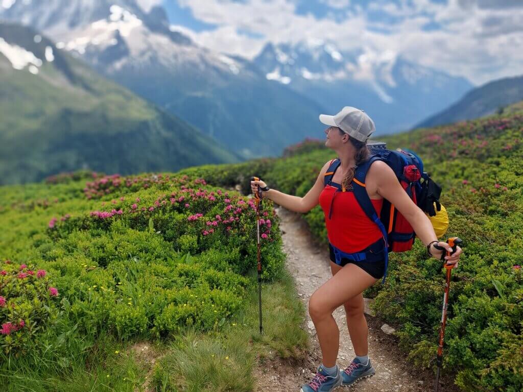
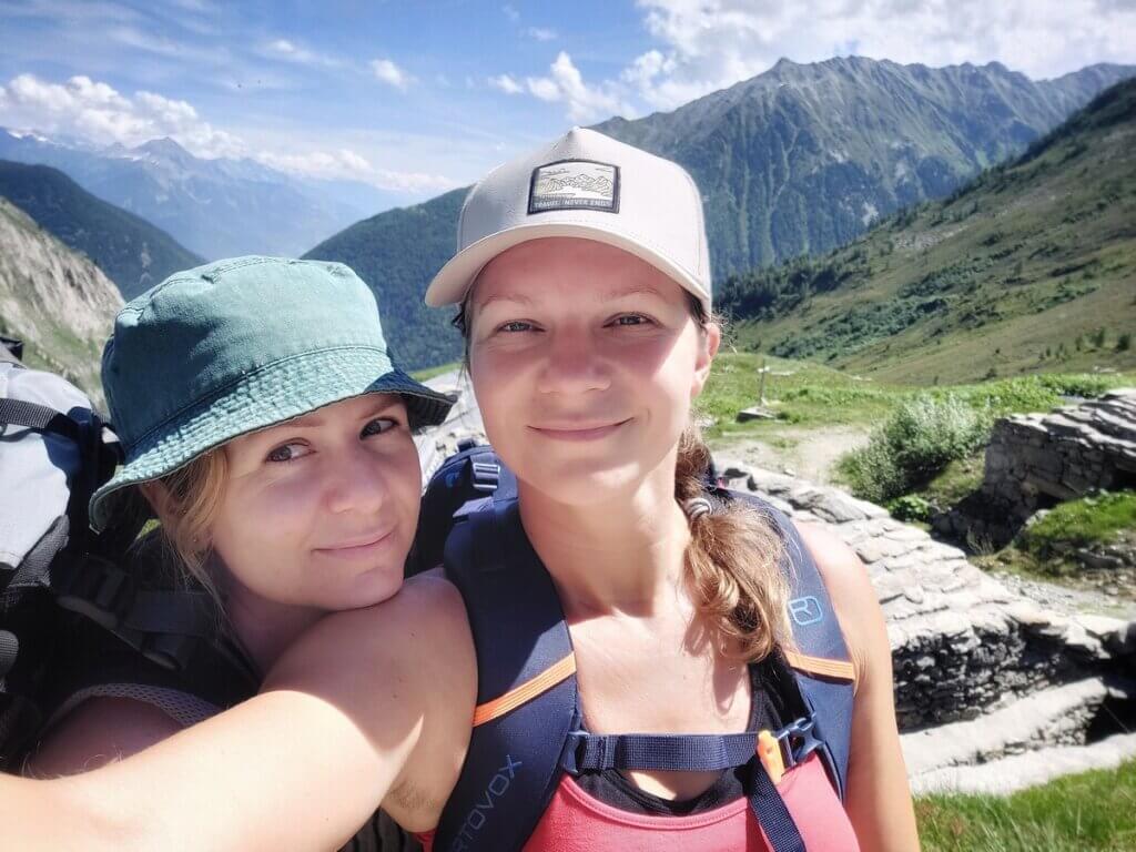
I know there are plenty of sites and itineraries for Tour du Mont Blanc but I still decided to sum up my own experience, my pain and sorrow and some practical information, too. Let it come in handy for those planning to conquer this 160km long loop surrounding the highest mountain of the Alps – Mont Blanc – 4810m.
Basic information
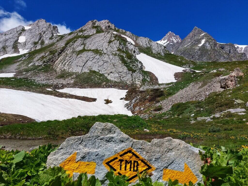
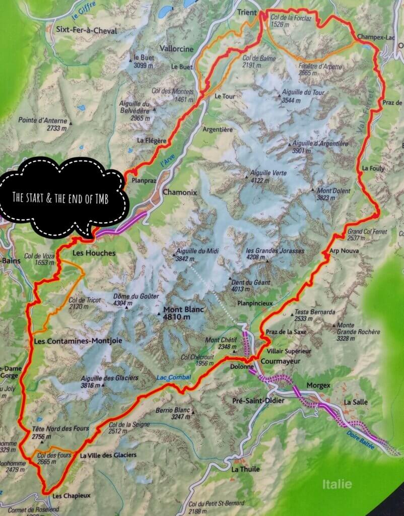
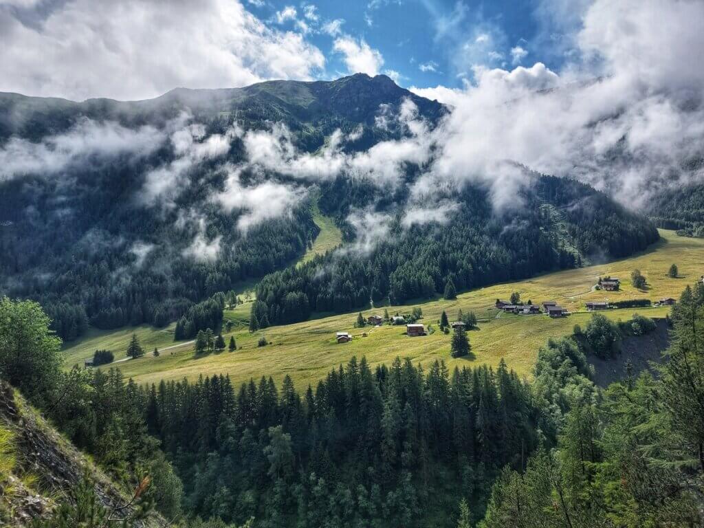
TMB (Tour du Mont Blanc) is one of the most famous long-distance hiking trails in Europe, circling the Mont Blanc. The trail covers around 160km with significant elevation changes, with a total ascent and descent of 10 000 meters. It usually takes 7 to 12 days to finish the whole loop. The route passes 3 countries, France, Italy, and Switzerland.
Accommodation
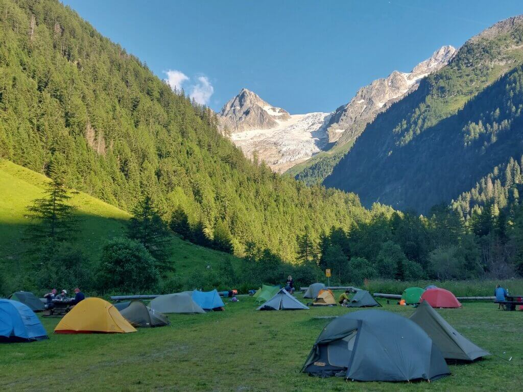
There are various refuges (mountain huts) on the trail, however, these should be booked pretty much in advance. Most people I talked to started making reservations 9 months in advance. Another option is camping as there are plenty of official camping sites which offer a spot for a tent, toilets, showers and some also offer option for breakfast. And as you can guess, my friends and I chose the option of camping (not voluntarily in my case haha).
9 day itinerary for TMB
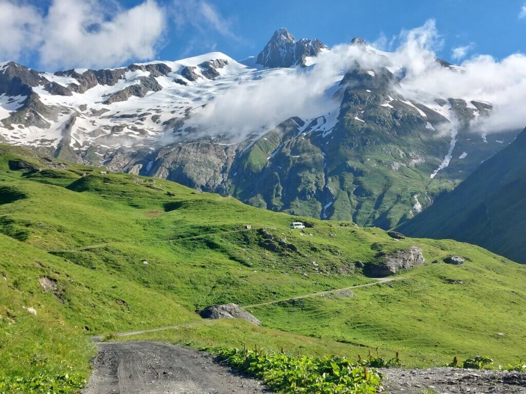
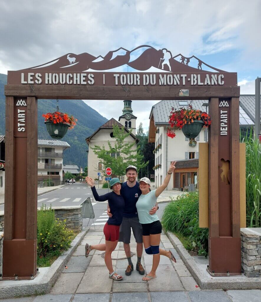
Day n. 1 from Les Houches to Les Contamines
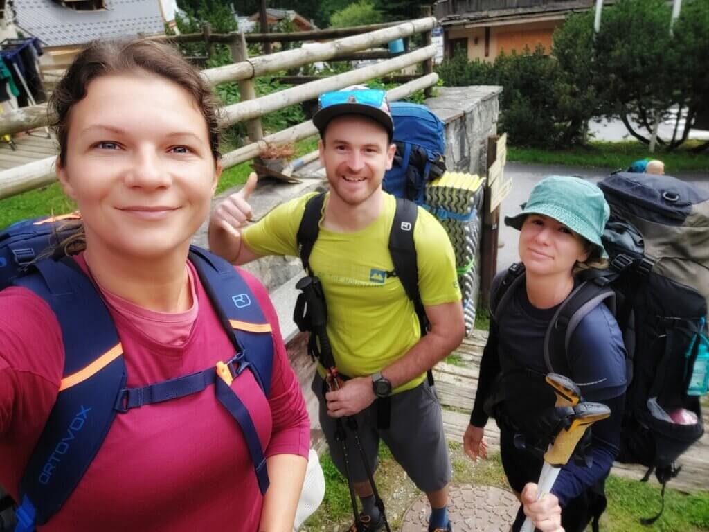
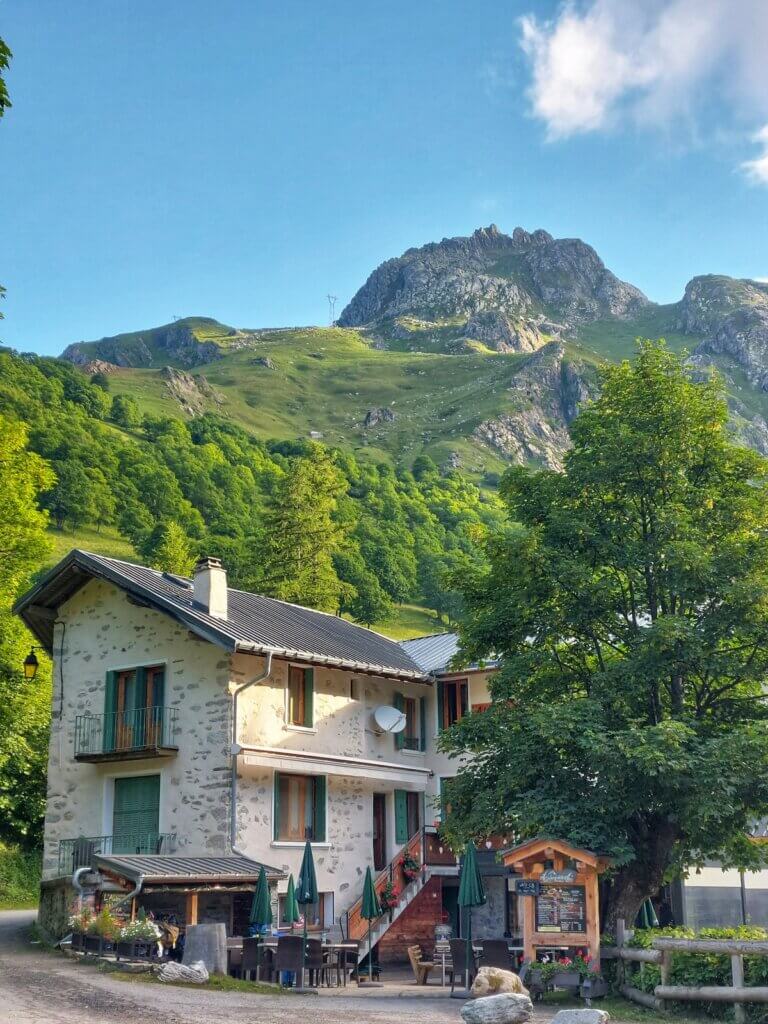
We left our car on an official and free parking spot in a small French town Les Houches which also represents the official start of TMB. On the first day we decided to do few extra hiking kms by continuing from Col de Voza via Col de Tricot all the way to the town Les Contamines. We stayed our first night in a camping site “Camping du Pontet”. And man, it was raining cats and dogs the first night. I didn’t get a lot of sleep that night.
The total elevation of that day was 1480m of ascent, 1320m of descent, 21,5km.
Day n. 2 from Les Houches to Le Chapieux
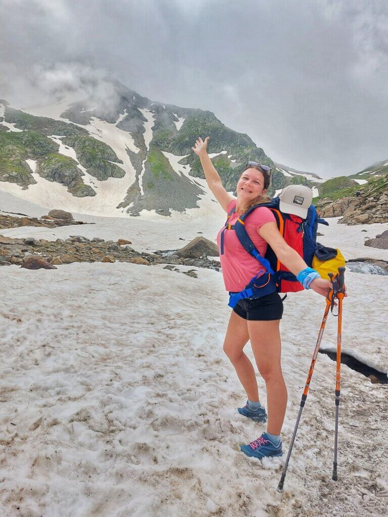
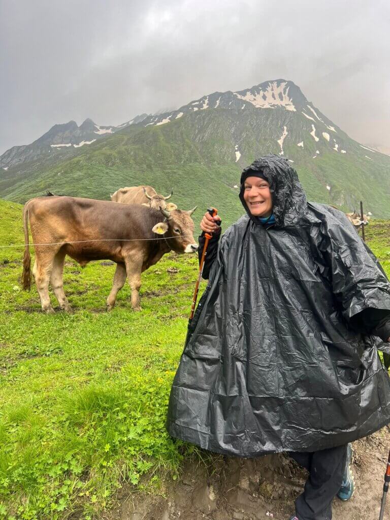
I woke up feeling sore and exhausted. We got some buffet breakfast at the camp for €11,50 and started our second day of TMB. The weather was cloudy and the first part of the day was tough, steep hill ahead of us. We reached the spot at the altitude of 2443m, there was plenty of snow. It was cold, cloudy and windy, therefore, we used all the warm clothes we packed for the tour.
Our saving point was a refuge Col de la Croix du Bonhomme where we warmed ourselves with some food and hot choco. We arrived to Le Chapieux with some rain around 5pm and instead of camping I decided to pay for warm and dry bed €66 in Auberge de la Nova, including 3 course dinner and buffet breakfast. Not the worst deal. They had only 2 spots available so I got lucky.
The total elevation of that day was 1310m of ascent, 920m of descent, 17km.

Day n. 3 from Le Chapieux to Courmayeur
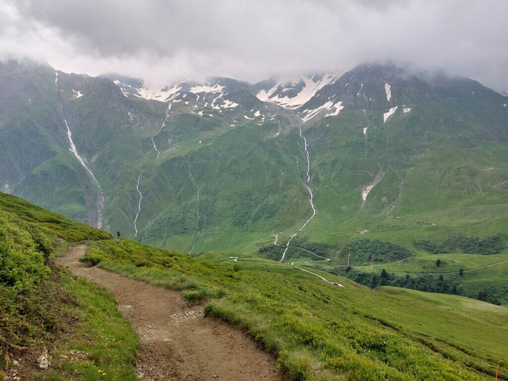
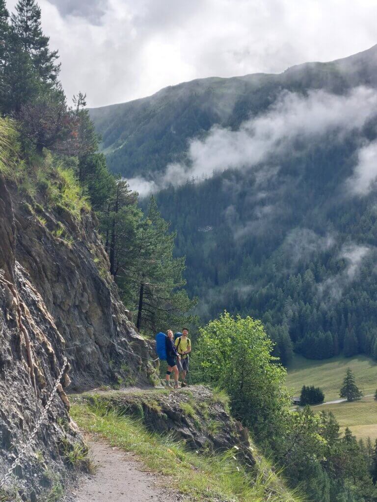
We woke up into a sunny day (finally) and decided to shorten our way by 7km by taking an official shuttle bus available for all hikers from Le Chapieux to Refuge des Mottets (our friend Martin was not very keen about it but Klara and I were very convincing and decided to take the shuttle). Then we continued in a sunny yet terribly windy weather to Col de la Seigne (2515m) which represents the border between France and Italy.
Please expect snow even in the middle of summer. We did this TMB at the beginning of July. After crossing to Italy, we took a little food break at another mountain hut Rifugio Combal. We arrived to our Italian camping site Aiguille Noire in Courmayeur in the late afternoon and paid €10 per person, €8 per tent.
The total elevation of that day was 650m of ascent, 1045m of descent, 17km.
Day n. 4 from Courmayeur to Arnuova Desot
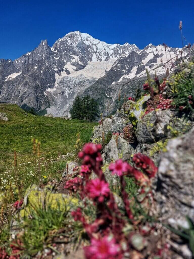
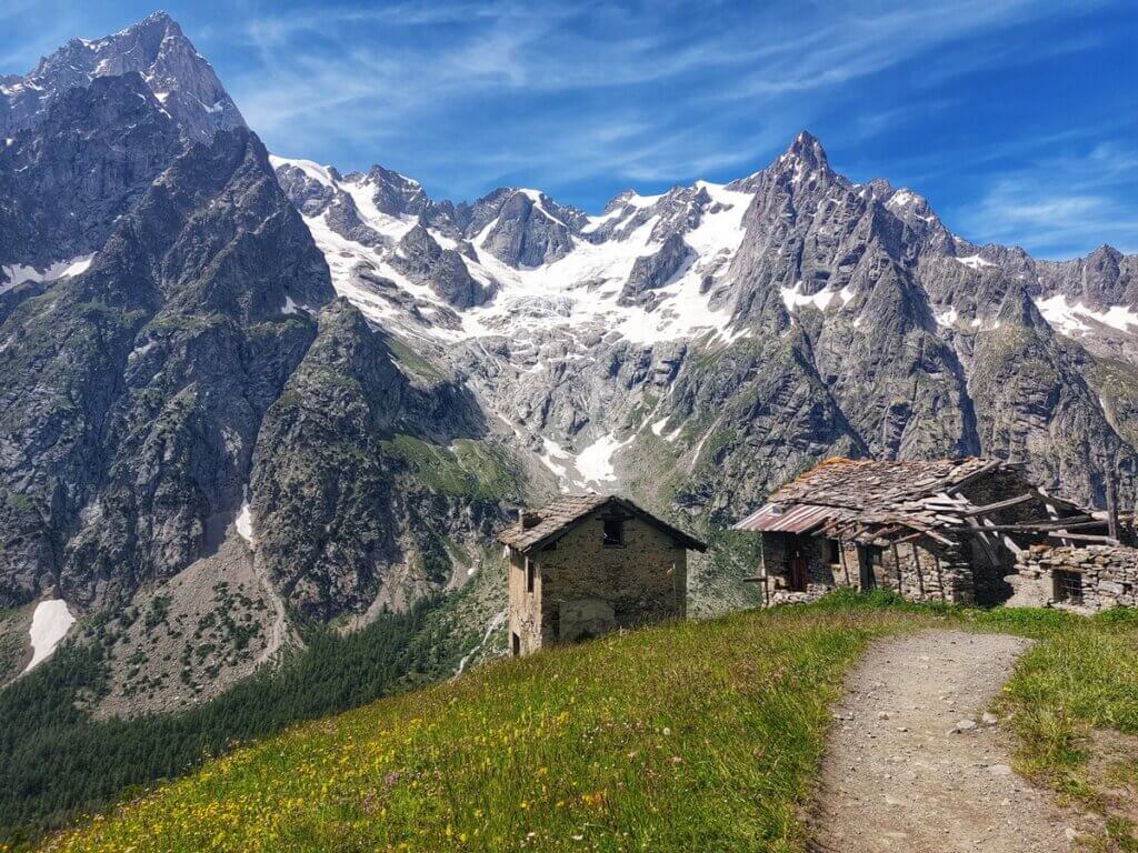
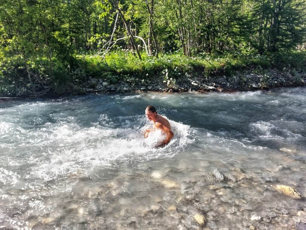
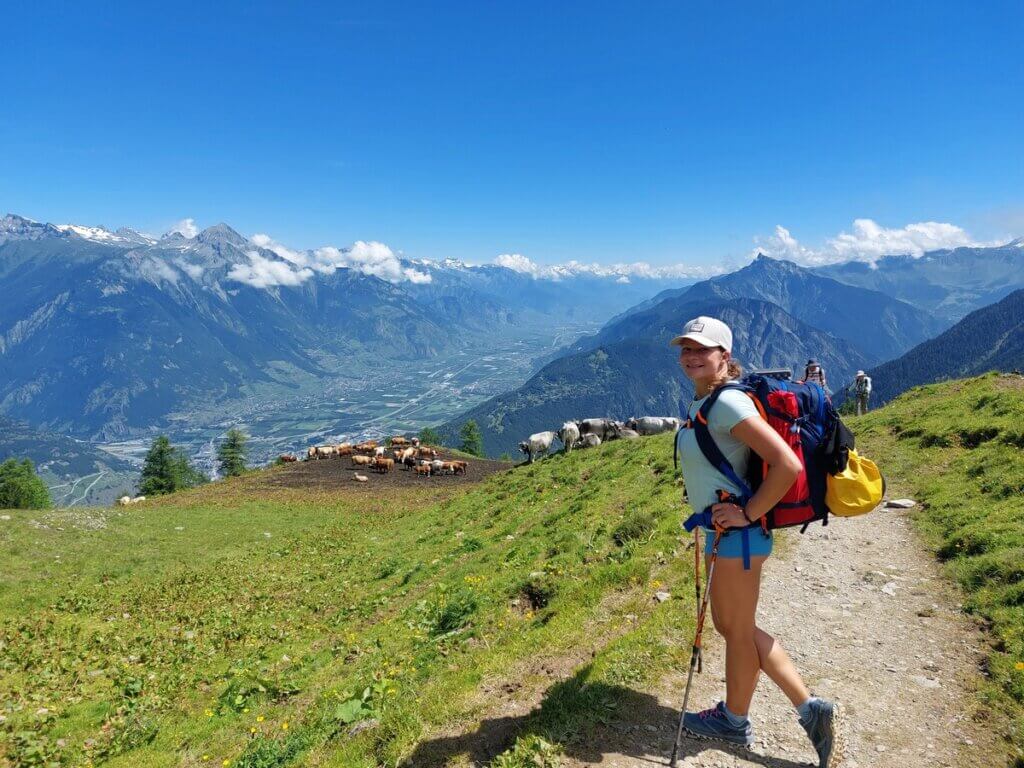
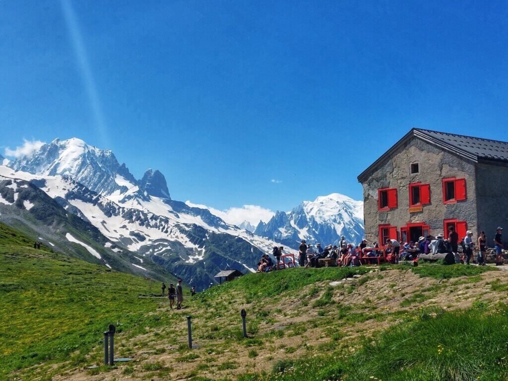
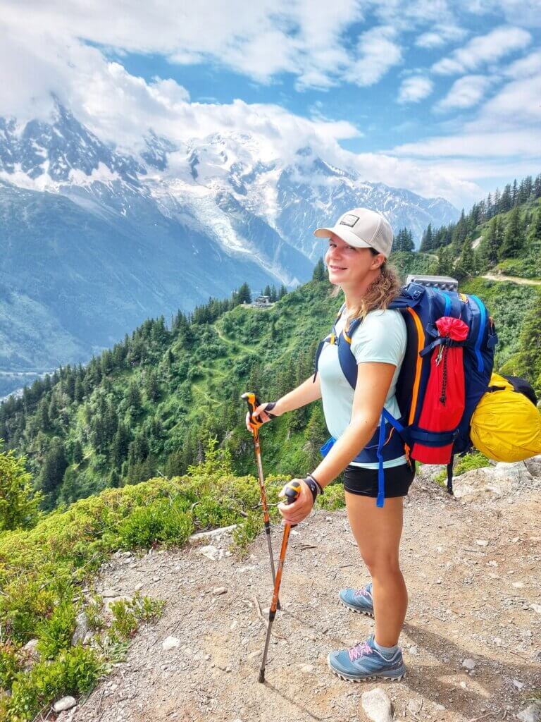
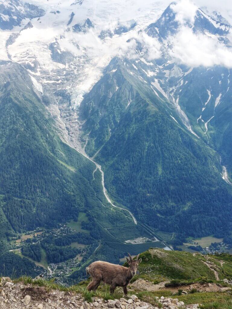
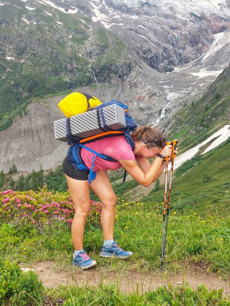
The day n. 4 was the best day with the best weather and ineffable views over Mont Blanc. And as a bonus it was a quite easy trail (apart the first two steep hours) OR maybe our feet already got used to the pain. The highlight was a short stay at the Rifugio Walter Bonatti which offers delicious meals and breathtaking views. At the end of the day I took a short ice river bath, some sweet dinner at Arnuova Desot and we camped in a place close-by to it. We didn’t have energy to continue all the way to the official camping site (it would be extra 10km).
The total elevation of that day was 1180m of ascent, 600m of descent, 18km.

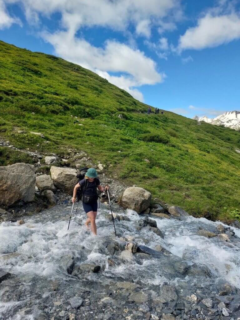
Day n. 5 from Arnuova Desot to La Fouly
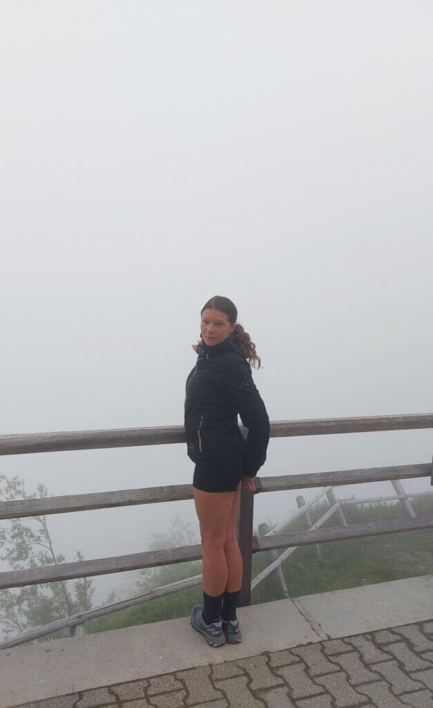
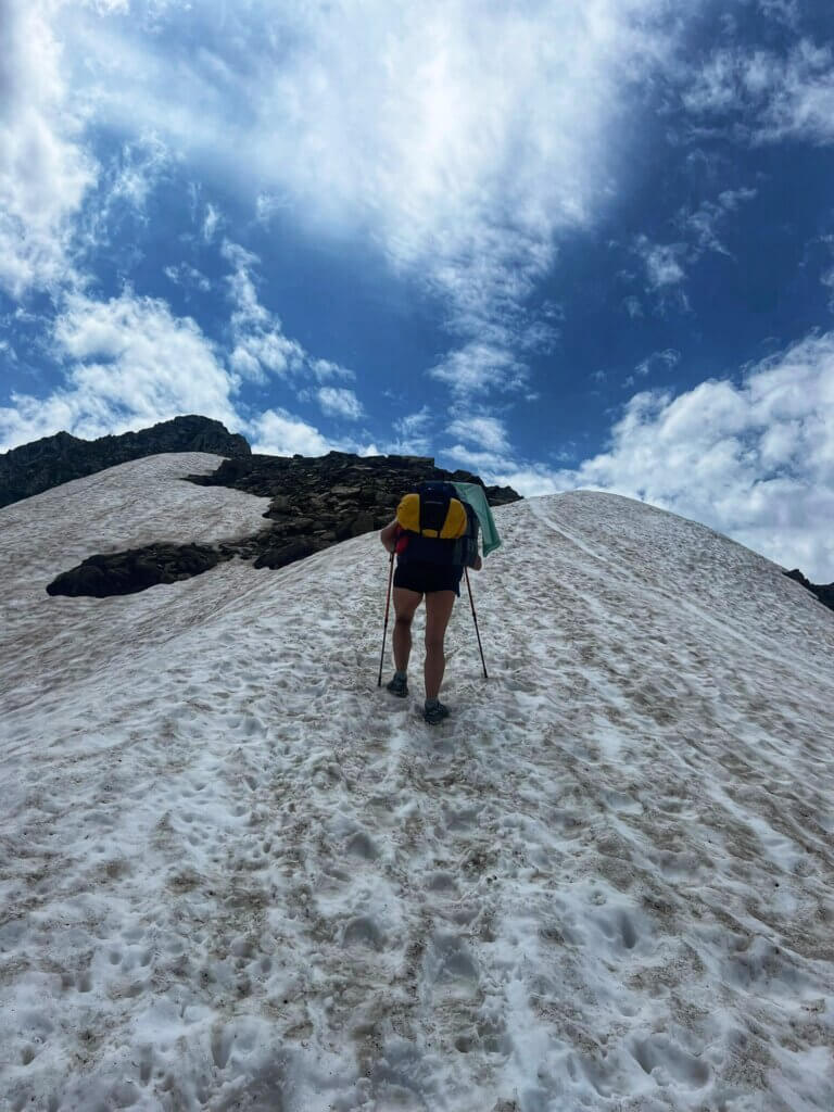
The day n. 5 of TMb was the mentally most difficult day. Klara´s feet were killing her because of her hiking boots. We woke up into the fog and there was zero visibility most of the day. The very first stop we did was at the Rifugio Elena for hot choco and we continued all the way up to the Grand Col Ferret which divides Italy and Switzerland.
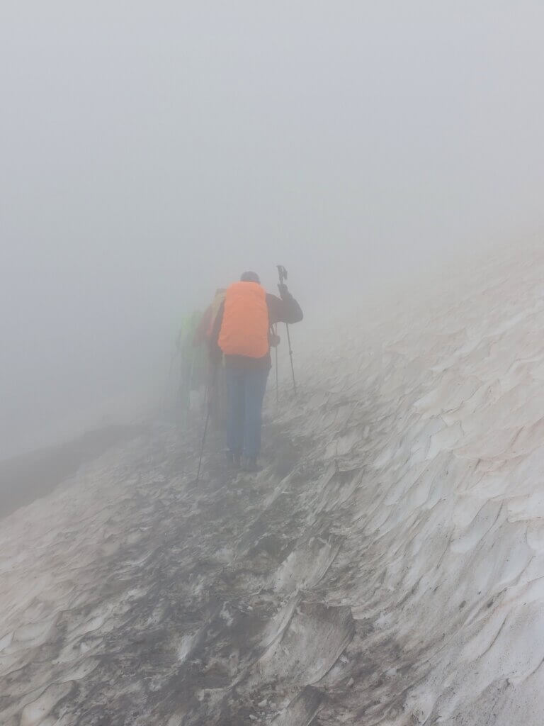
We entered Switzerland being lost in the fog with plenty of snow around us (snow pikes would come in handy, we didn’t have any). At the hut La Peule it started raining heavily so we arrived to La Fouly town completely soaked and cold. Instead of continuing our journey, Klara and I persuaded Martin to stay the rest of the day and night in a beautiful cozy and warm accommodation Gite de la Fouly. I negotiated a better price, €200 per 3 people with delicious three course dinner and amazing buffet breakfast in a private room.
The total elevation of that day was 750m of ascent, 770m of descent, 10km.
Day n. 6 from La Fouly to Champex Lac
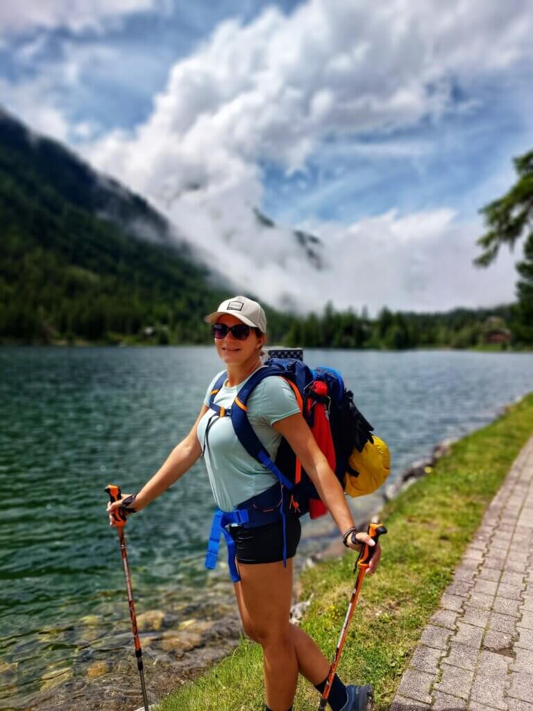
After an amazing rest half-day and even better night in warm, dry and cozy bed we continued our TMB. It was a pretty easy day. No more rain. Bit of sun. No steep hills. We crossed few Swiss villages such as Praz de Fort and Issert and we arrived to the lake of Champex in the afternoon. The first thing we did in Champex Lac was to buy new hiking sandals for Klara (what a relief) and accommodated ourselves in another camping site Rocailles. The most expensive camp of TMB. €21 per person.
The total elevation of that day was 470m of ascent, 600m of descent, 15,5km.
Day n. 7 from Champex Lac to Trient/Le Peuty
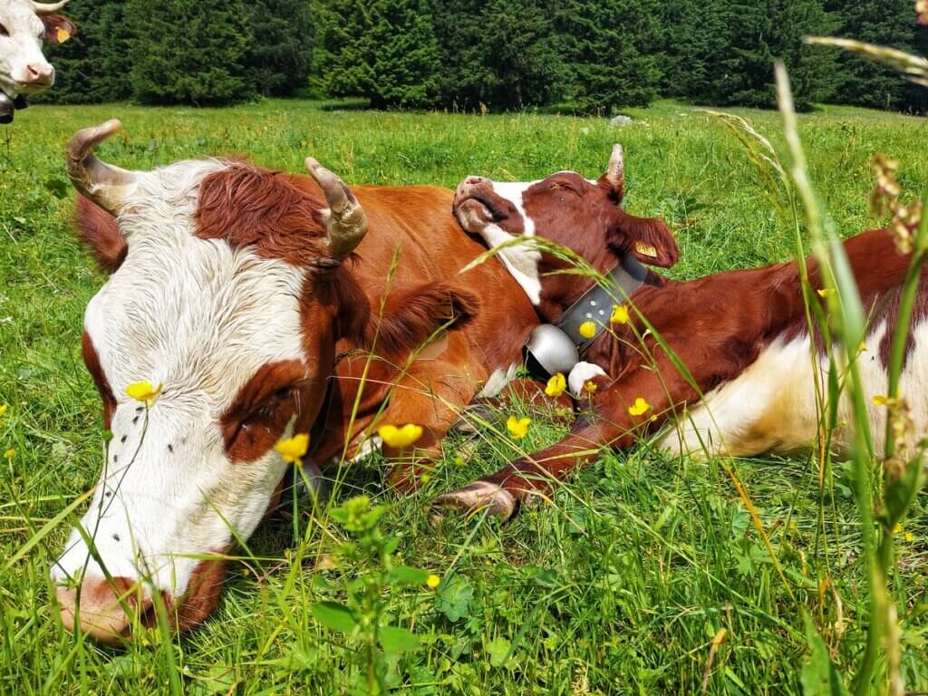
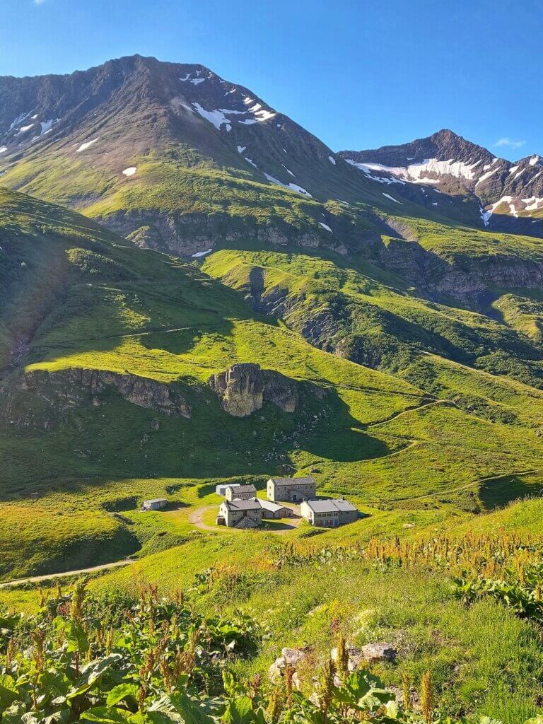
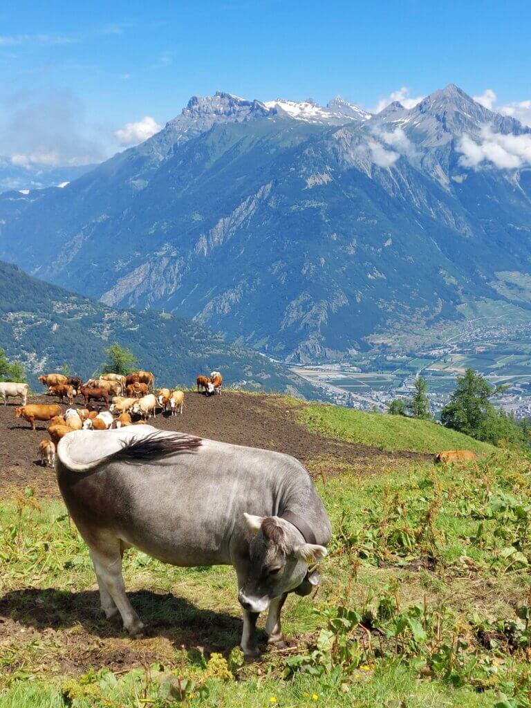
We ate our buffet breakfast for €15 in close-by bakery Boulangerie and decided to separate and take two different routes. Martin took the more difficult one via Fenetre d´Arpette (2665m), Klara and I took the easier one via Col de Portalo (2049m). It was another kind of chill day with sunny weather and plenty of people around us. We stopped at Alpage de Bovine hut for some water and proper relax time surrounded by the bells of Swiss cows. We arrived to our camping site Le Peuty in Trient around 4pm. There is no signal, no wifi. The reception, a small shop and showers are open only from 4 to 7pm. The price was only €8 per person. The price for shower was €2 for 7 minutes. Yet it was the nicest camp with the best views over the glacier.
The total elevation of that day was 730m of ascent, 890m of descent, 15km.
Day n. 8 from Le Peuty to Argentiere
On that day we actually didn’t arrive all the way to Argentiere town, we stayed in the area called Tré-le Champ, close-by the Argentiere town. In the morning before the hike we had a buffet breakfast at the neighbour hut Le Peuty for €11. Then a steep hill was waiting for us in order to get to the mountain hut Col de Balme (2191m) which is considered to be the border between Switzerland and France.
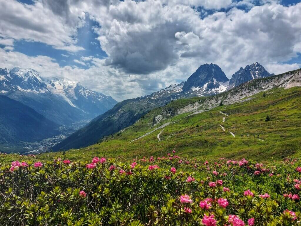
From there after a proper break time and water refill we decided NOT to take the regular cable-car way down to Argentiere, but instead to continue via Col des Posettes to have more astonishing views over Mont Blanc. Weather was in our favour. This was probably the second best day of the hike when it comes to the views and the trail itself. We arrived to the most charming wooden hut Auberge La Boerne where they let us pitch our tent for free if we took their half-board for €35. The best price deal so far.
The total elevation of that day was 1060m of ascent, 1000m of descent, 12,5km.

Day n. 9 – LAST DAY of TMB – back to Les Houches
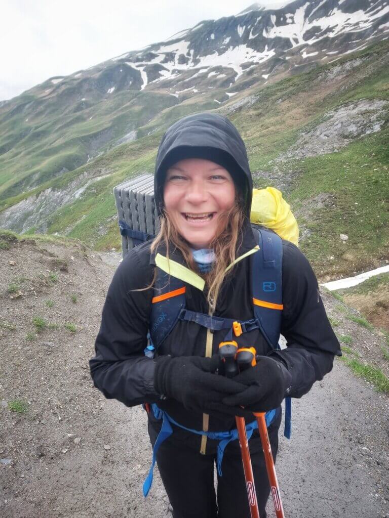
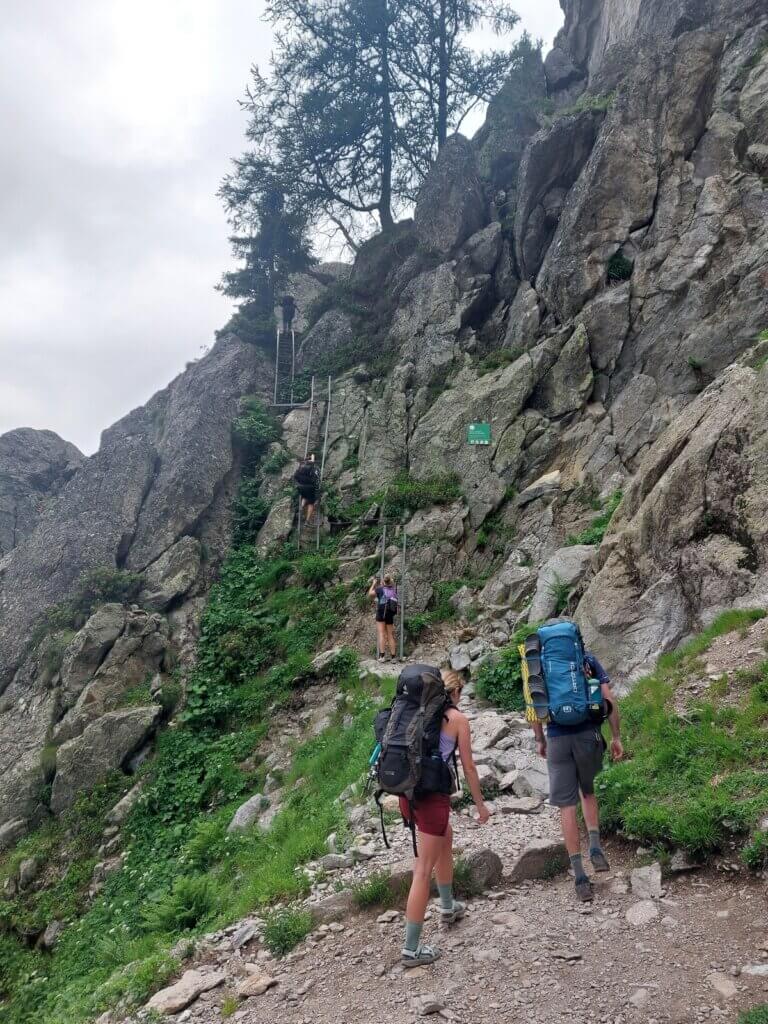
This was literally the most difficult and exhausting day as most people divide this day into two, we decided to speed up our TMB by hiking it in one day. What a mistake! Our first break stop was at La Flegere – a place of the cable car connecting Chamonix. This was the first steep part of the trek which also included some ladders climbing. In rain! Then there was a long kind of moderate trail without any steep ascent or descent. It was more of a never-ending trail till we got to the altitude of around 2550m with plenty of snowy parts.
We reached another steep hill place Le Brevent from where most of the sane people would take the cable car to descent down to Chamonix, but NOT US! We decided to descent 2000 steep meters back to Les Houches on our own. OMG! I didn’t remember last time I had been in so much pain than in this part.
My knees were killing me and each step was more and more painful. On the way down we stopped for a bit at Tete de Bellachat mountain hut (the nicest hut so far!!) and then at the asphalt road at Parking de Merlet Amont I decided to hitchhike the last 3 km and a super kind French grandpa decided to put us out of our misery and gave us a ride all the way to Les Houches where Martin was already waiting for us. What a machine!! We spent a night at camp Les Cimes in Chamonix for €12 per person.
I had never felt so relieved for something to end like this TMB trek!
The total elevation of that day was 1500m of ascent, 1550m of descent, 22km.

BUDGET for TMB
Accommodation: €197
Food: €250TOTAL: €447
Regarding the accommodation, two nights were for higher price paying not only for warm bed but also for three-course dinners and buffet breakfasts. But to sum it up, the TMB trek doesn’t have to be expensive. It just depends on how much you want to spend on it and how organized you are. If you book all the huts 9 months in advance you will have it more expensive BUT also more comfortable.
We travelled to and from Chamonix by car from Slovakia so we divided the cost for the gas and highway fees equally, it was around €173 each.
I also spent extra money on cable car to Auguille du Midi in Chamonix (€80) and also for some souvenirs (around €60).
SUMMARY
I am extremely proud of myself for accomplishing the whole Tour du Mont Blanc trek. TMB was worth doing. The views are wonderful most of the time, the mountain huts, camping sites, food, people, vibes – all amazing!
However, I decided to NEVER do such a long-distance multiple day hiking trip again. It was beautiful for the first few days but then it just got uselessly exhausting for me. Two, max three days for hiking is the perfect number for me!
Any questions about my TMB hike?? Ask in the comments below or check my MiliMundo Instagram account where everything is already mentioned.
If you want to receive all articles which I publish, feel free to sign up below.
And if you liked the article and you want to contribute for my future MiliMundo travels (hopefully accident free), don´t hesitate and do it now.
![]()
If you are interested in CENTRAL AMERICA – click HERE.In SOUTH AMERICA click HERE.
PS: Looking for great travel insurance with great prices for your future travels? Insurance which you can book even when your journey has already started? Have a look at The True Traveller. I am more than happy with them.

Superbe reportage. Une petite question, pour se nourrir, il faut porter plusieurs jours de nourriture dans son sac ou bien possible d’acheter chaque jour à manger dans d’éventuels magasins ? Merci.
Hi there, regarding the food, it is NOT necessary to carry your own food, maybe some snacks and fruit for a day but then during the day you will cross multiple refuges (mountain huts) where you can buy some food, sometimes some small villages with shops, so the food was not a problem at all 🙂
Hello!
Good cheer to all on this beautiful day!!!!!
Good luck 🙂